Minutes from the Grand Strand Awaits a Slower Pace
 |
| Hog Inlet |
Little River, SC
Get away from the hustle and bustle of South Carolina's Grand Strand and enjoy the history and natural beauty of Little River. There is an abundance of serene places to stop and take in the coastal southern charm. The town is just north of Myrtle Beach at the North Carolina border. If you are coming from the beaches of NC it's just a quick drive south on Highway 17.
 |
From their Facebook Page
|
The first thing you see as you enter SC from the north is the
Stateline Fireworks store. As a college student in Wilmington driving to Myrtle Beach to party on the weekends, the fireworks stand was the first reminder that we were entering the otherworldly beach destination known as
the Grand Strand. Tacky tourist attraction overload, mega mini golf mecca, planted palm trees, high-rise lined beaches, and amusement parks for miles and miles. The first 'town' you come to as soon as you enter SC is Little River. Back in college, I didn't know it even had a waterfront, or anything other than fireworks, a place to stop and get cheap gas and lotto tickets, and then quickly go over the bridge to other places on the other side of the
Intercoastal Waterway, (ICW). In NC decades ago, both fireworks and the lottery were illegal, and gas still today is taxed several cents higher than its neighbor to the south.
A Tiny Waterfront Town
 |
Little River Waterfront
|
A few years ago my friend Randy moved to Little River to enjoy his retirement. At the time I was doing a lot of traveling. Most of it by myself, camping or visiting friends. It was a difficult time in my personal life and I enjoyed solitude in nature, it was cheaper than therapy and healthier than drinking. I visited my friend in Little River. He lives in a neighborhood just off 17 before the bridges over the waterway. The neighborhood had once been a massive golf course. Multiple courses actually. Only one remains and at the time of my first visit the others had long since turned into woods just behind the homes. Throughout the bramble of cedar, palmetto, and pines were giant live oaks and beautiful blooming dogwoods that the original golf course developers had saved from the old growth forest that was there before it was ever touched by bulldozers. In the woods were still paved paths, canals, waterholes, and berms from the golf course. It was a beautiful place to explore. (It has since been redeveloped.)
 |
Oak trees & Big M
|
I decided to go to the waterfront. It is tiny. A sandy grouping of seafood restaurants on a bluff above the Little River, (now part of the ICW). There are more giant old oak trees full of Spanish moss and ferns. There's a huge parking lot. In the water there are fishing boats docked and a big cruise boat that takes tourists out onto the ocean to gamble. The
Big M casino is the obvious economic driver for the waterfront. I went at a time when there was no gambling cruise scheduled and the parking lot was empty, the restaurants were mostly closed but
Key West Crazy's was open. I sat on the deck. They had roll up plastic walls and heaters so it was usable all year long. I had margaritas and coconut shrimp. The waterfront is beautiful. It feels a million miles away from the chaos I was used to in Myrtle Beach.
The Native People
 |
Artifacts in the Horry County Museum
|
Of course there is a history to Little River as complex as any small southern town. There was an entire civilization pushed out and killed off. There is archeological evidence that the Waccamaw and Pee Dee Indians and their ancient ancestors used the Little River's inlet as fishing grounds, camping on the nearby islands during the season when the fish were plentiful and shellfish were fat. For thousands of years these people flourished. As I've written about in previous posts, they were eventually forced to take to the dense swamps away from the coast to escape violence and illness brought by invaders from across the ocean.
The European Invasion
 |
King's Highway
|
Little River is one of the oldest European settlements along the South Carolina coast. Though records are sparse, artifacts and oral histories conclude that subsistence farmers and fishermen came to the area and stayed as early as the 1600's. There was a difficult swampy forest between the Carolina coastal settlements in those days. In the area Conway was the larger 'Old Town' further inland and Little River was considered the 'New Town'. To the south was Georgetown and then Charleston, with vast stretches of wetlands and wilderness between them.
The King's Highway
Highway 17 is called King's Highway for good reason, the original King's Highway still follows almost its exact route through SC. Between the mid 1600's and the 1730's the English constructed the road meant to connect the important colonies of Boston and Charleston.
A Colony Divided
The Carolina Colony was divided into North Carolina and South Carolina in 1712, though the border was a matter of disagreement politically. In 1730 an agreement was reached that put the border 30 miles to the south of Cape Fear running parallel with the river. This arrangement wouldn't last and surveyors were brought in by the north colony and the southern one and the border was drawn and redrawn over and over for the next hundred years.
The Land Grants
Imagine the Crown as Oprah, if you will: "You get some land, and you get some land, and you, and you, and you!"England was giving out Lord Proprietor land grants and the area that is now Horry County went to several planters, notably the Withers family, and James Minor. Waties Island is named for William Waties, the father, the son, or the grandfather, no one knows for sure, all three were surveyors. Some records show that a William Waties owned 1,150 acres in the Little River area in 1733. This acreage could have been obtained by a Lord Proprietor's grant in 1670, that was given originally to James Minor, but as the surveyors of a vast land grant the Waties may have been paid in acreage. At any rate by the mid 1700's the existence of records didn't matter, King George gave land grants to several more people, hoping for better success in settlement. After all, these land grants were given with the intention of creating additional revenue streams for the crown. A King's grant gave some of the area land to William Allston, though the island remained named Waties. (You may recognize the name Allston from previous posts, the family of politically and militarily successful rice planters who acquired vast amounts of SC land.) The land to the south was granted to William Gause, who built an Inn at Windy Hill, now North Myrtle Beach. The Wither's family held on to their land, Wither's Swash, for generations, (a swash is a creek that runs from the ocean). The Vereen's, a family of French Huguenots, who came to the colonies in 1680, had the land near Singleton Swash. The Vereen original home site is believed to be located about 2 miles north of Singleton Swash.
 |
The Southern Tour
|
George Washington Visits
George Washington traveled down the King's Highway on his Southern Tour in 1791. He is said to have stayed the night in Windy Hill, had lunch in Little River, and then was guided through the wilderness area to Georgetown by Jeremiah Vereen, a indigo and rice planter, and hero of the revolution.
The Randall-Vereen House
 |
Historic Registry
|
After the War of 1812, yankee Thomas Randall built a large home overlooking the harbor in Little River. It became part of the Vareen family's plantation as they bought up more and more of the land in the area. The home stood until it burned in 2014. It was known as one of SC's oldest homes. Its charred remains sat eerily for some time, like a tombstone to the home's long history.
The War of Northern Aggression
A Confederate battery was built at the point just behind the barrier island where Sheephead creek comes out of Dunn Sound into the area where the Little River empties into the Atlantic ocean. It defended the entrance to Little River Harbor and was called Fort Randall before being captured by Yankees in 1863.
 |
Path through pines at Vereen Gardens
|
The Vereen Gift
Jackson Vereen was born in Little River in 1882, close to the end of his long life he deeded some of the family's land to the Horry County Historical Society in 1972. Today 115 acres is preserved as Vereen Memorial Historical Gardens, known for it's natural beauty and historical significance. On highway 17 south just past the fireworks store on the left. At the Vereen property there is still a section of the original highway. At the gardens there is also a Vereen family cemetery with graves as far back as the American Revolution.
The Island
The coastal land known as Waties Island actually consisted of a barrier island, and behind that a marshy flat with a small sound, two tidal creeks, and a larger inland section sandwiched between the marsh and the Little River (now part of the ICW). This land changed hands often as it was not considered useful for farming or lumber, and was difficult to access. In the 1920's as a new interest in and romanization of southern plantations brought wealthy industrialist heirs to the region, Horace Tilghman bought the land. At Tilghman Point there are still the remains of the Confederate battery
 |
Erosion on Waties
|
The Tilghman Gift
Horace Tilghman's heirs, the Boyce family still own 400 acres of the the land. Tilghman's granddaughter Anne gave the Coastal Educational Foundation of Coastal Carolina University 1/3 of the island to be preserved for use as a natural laboratory. One of the heirs sold their portion to a real estate holding company from Virginia with no plans to develop their property. The handful of private owners agree on preservation but continue to disagree on the means of preservation, some want State Park status while others want it to remain protected as an untouched natural area.
 |
From their website
|
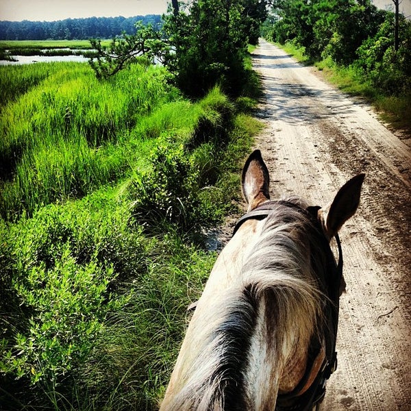
Historic Horse Ride
Currently the area of land known as, the Little River Neck area, is home to Inlet Point Plantation, a sprawling horse farm that offers rides on trails through the inland property as well as over the small causeway and onto Waties Island's beaches. If you aren't an environmental scientist or student with Coastal Carolina, or a Tilghman heir, the horse ride is your only option to access the untouched beach by land. Of course, there's always the water. That's how I arrived on Waties Island's beach.
 |
Cherry Grove Public Boat Landing
|
My Kayak Adventure
I googled kayak rentals in the area and the one that interested me offered several guided tours and even one called the Sunset and Lantern Tour. I quickly gave J and L Kayaking a call and made my reservation for that evening. It was winter but the weather was amazing. I drove over the bridge toward Cherry Grove Beach. Cherry Grove is a beach that was developed during the post WWII boom of the '50's and '60's and consists of beach front homes and rows and rows of homes on manmade channels. My mom vacationed there as a child. I drove towards the north west side of the island and met the guide and other kayakers around 3pm at the Cherry Grove Boat Landing.
 |
Waties Island from the creek
|
We paddled slowly down House Creek towards Hog Inlet. It was perfect weather and the water was smooth. It was actually one of the most enjoyable kayak trips I've ever taken. A high pressure system had pushed away any clouds that morning and the bright sun was warm with a light breeze occasionally. As we passed through the homes of Cherry Grove we were greeted by a paddle boarder with a dog who was dancing and jamming out to music as he paddled downstream. Because there were two families with us and unexperienced kayakers, I was able to paddle around quite a bit by myself while they slowly made their way down the creek. It was immensely relaxing. The island has suffered erosion at both inlets due to dredging and the heirs even sued at one point for lose of property. The stand of tall trees you see in these pictures is slowly eroding into the water.
 |
My Sand Dollar
|
We beached our kayaks just before the inlet at Hog Point. We had time to walk the beach before sunset and enjoy the solitude. I found a sand dollar almost immediately. The beach was huge, and serene. There were no footprints. No tracks from lifeguard vehicles or tourists dragging their stuff through the sand. I did see evidence that a couple had recently come through on horse back, at the low tide line was a pair of tracks disappearing and reappearing in the gentle waves.
 |
Dusk on Waties Island
|
We enjoyed the beach until dusk when the guide called us back to the inlet. Sunset was coming. From Hog Point we would be able to see the sunset over Cherry Grove. A mist started to roll in off the ocean, it was beautiful. As the sun began to set a flock of birds flew across the inlet. The guide was handing out the lanterns, they're inflated waterproof glowing cylinders. As the sun dropped below the horizon we launched our kayaks back into the creek.
Night Kayaking
 |
Sunset, Hog's Inlet, & Cherry Grove
|
I launched first and paddled out away from the families as they slowly got in their kayaks and were pushed out into the water by the guide. I absorbed the feeling of the air. The light moisture coming in off the Atlantic, the salt smell, the lapping of the water under me, the moments just after the sun has set when the sky is still full of a complex range of colors, I took deep breaths and soaked it all in. The lantern that J and L provided was the perfect amount of light for people to see the kayakers but still not obstruct night vision. I had never kayaked at night before. I had always wanted to and I had paddled out during sunset, but never far enough to be paddling home in the dark. It was so peaceful.
There were bird sounds, and there were bug sounds, and there were frog sounds, and the sound of the paddles in the water, but there were no other sounds, until we were paddling through the large homes of Cherry Grove where there were sounds of laughter and music. It was obvious that it was the down season, as only a handful of homes looked occupied, most were dark, silently awaiting the return of warmer weather and weekly renters.
I highly recommend the J and L Kayak experience, if you are in the area and want to get back in touch with nature, its a great escape.
We are lucky that the families who inherited these properties believed in preservation. Driving away through the tightly packed homes of Cherry Grove I thought about the beautiful high marsh behind Waties and realized that is what this island looked like before it was cut up with channels and developed. Little River is a perfect place to take in nature or history and get away from the hustle and bustle. It is much more than a fireworks stand.


No comments:
Post a Comment