What it's all about...

Exploring Natural Places in the Southeastern United States, Uncovering Hidden Histories, and Examining Local Mysteries
Showing posts with label history. Show all posts

Wednesday, September 30, 2020

Carolina Coal Demon

 Death in the Dark 

The Story of the Deep River Coal Demon


Deep under the North Carolina ground is a black vein of dirty decay. The Deep River coal field is an area of Triassic rocks stretching 36 miles along the river in Chatham, Lee, and Moore Counties. In the age of dinosaurs there was a vast swamp along an ancient river. As swamps tend to do, decaying plant matter formed layers of peat in the humid dense environment. Over huge amounts of time shifts in plates and other events changed the landscape and large amounts of sediment flowed down and gathered in the area. The pressure of the massive layers of sediment created the perfect situation to turn the peat into coal. For 200 years people have attempted to dig this coal out of the ground. Deep River is NC’s only commercial coal bed. 


The coal industry has always been extremely dangerous and historically, many tragedies have been associated with mines. Over time, the abundance of illness, death, and mishap creates a need for explanation in the human mind. As we often do, people created legends to place blame somewhere that would give them the opportunity to feel like they could continue working by creating superstitious ways to protect themselves. It was a way to rationalize a terrible industrial human rights travesty without placing blame on the industrialists.

 In NC's coal mines, the scapegoat came in the form of a demon. The Deep River coal field is cursed by this disturbed demon, and many have lost their lives in his clutches. 


The demon has guarded his coal through each attempt to plunder it. No one has been profitable off of the mine due to the disastrous explosions, cave ins, and flood outs. The Old Egypt mine and the Carolina mine should have been successful, they supplied coal to the railroad and the Confederate Army during the Civil War. But unfortunately the complex geology of the region made mining difficult. There was ground water and there were intrusions and veins of softer minerals that caused unexpected weakness in the tunnels. The coal itself seemed to be cursed and stories came back from the battlefields of the dreaded Deep River coal that burned yellow giving away their location to the Union soldiers. Sales to the military stopped and money owed was not paid due to the loss of life. The mines closed for almost two decades. 

A company with a new plan opened the mine to great success. The mine employed upwards of 80 miners who earned what was considered a good wage, drawing miners from the north.  A few specialized men worked as blasters, places and igniting the TNT to break loose the coal. Most of the men worked as loaders. They shoveled the freed coal into carts, which were then carried away by mule.

The first disaster struck on a winter morning. At 8:30 a.m. on  December 19, 1895 an explosion ripped through the Egypt Mine. Forty-six of the sixty-seven men in the mine at the time perished.  The cause was believed to be natural gas ignited by a flame in a miners helmet.  

The company struggled to keep going but in May of 1900 another gas explosion killed twenty-two miners. It really was too much for the already limping company.  In two years, the Egypt coal mine was closed again.

The Carolina Coal Company was formed in 1921 with the intention of developing a mine across the river from the Egypt Mine. In its first year of full-scale operation it more than doubled the best of the Old Egypt Mine's output. Again things were looking up for the Deep River Coal Bed.  But once again the profits failed to materialize.  

In the spring of 1925 at seven in the morning seventy-four miners went down into the dark of the Carolina Mine.  Fifty-three of those men did not leave the mine alive.


The Carolina Mine closed a few years later when the mine began to flood through an air shaft.  The water was pumped, but they made no precautions against future flooding.  So it happened again and after the mine flooded again in 1930 it was closed.

During the post WWII boom era the mines were reopened as tourist attractions but the stories of tragedy attracted night time trespassers and the mines went into disrepair with miss use and were later closed completely. The coal still sits under the earth. Tempting modern fortune seekers to risk it all and tempt their fate with the Carolina coal demon.

Friday, September 25, 2020

The Fort Fisher Hermit

Robert E. Harrill


(February 2, 1893 – June 4, 1972)

The Fort Fisher Hermit


At the age of 62 Robert Harrill hitchhiked his way to the end of the earth. If you start driving east in the foothills of North Carolina and don't stop till you run out of land you might end up there too. Fort Fisher is the tip of a peninsula called Federal Point, just before you get to the islands that make up the Cape Fear. Growing up on the coast, I heard stories about the Fort Fisher Hermit my entire life. I think the very earliest I remember learning the story was the early 1980's, I was four or five. My twin sister and I were sitting on a beach blanket in the back of our family's Carolina blue WWII Jeep.

We were holding on as we bounced along the east beach on Bald Head Island. We often went out to 'the point' where the east facing and south facing beaches come together and form the cape. This was the first trip I can recall when we headed north up the beach past Middle Island and into the 12,000 acre preserve. We went all the way to the New Inlet, which by then was not so much an inlet as a flat where the ocean reached across the sand at high tide and spilled into the marshy bay behind it. It was high tide by the time we had our picnic lunch and so going the rest of the way up the beach to Fort Fisher was not an option. Story telling was. Dad told the tale of an old hermit who had lived just up the beach from where we were. People from all over drove out on the beach from Fort Fisher to sit with him, hoping to gain wisdom from his lifestyle. The ride up the beach seemed endless and there was nothing out there but sand dunes, marsh, wind stunted junipers, and palm trees. I imagined the hermit, as a man on a deserted isle.

That is probably how popular culture has imagined him as well. The truth is, he was a troubled homeless man who opted out of the pressures of modern American society.  Harrill was raised in an abusive home, they were poor, with no electricity or indoor plumbing. He spent a lot of his childhood playing in the woods to escape the traumatic home life. In 1913 he got married and the couple had five children. It wasn't a happy home. The eldest son tragically took his own life and Harrill's mental health deteriorated. He was unable to hold a job and support his family. His marriage was failing. His wife knew he would no longer be a caregiver for their family. During the Great Depression the marriage ended and Harrill was institutionalized. In 1955 he took his fateful hitchhike ride.
Life in and out of mental facilities, jail, and, halfway houses was terrible and Harrill decided it was only making his condition worse. Life would be better by the beach. Several hundred miles later he saw the ocean. He walked from Carolina Beach down to the Confederate Fort where he camped for a while in a tent. He was considered a community nuisance, as he was collecting things off the beach and living on land he did not own. He was charged with vagrancy and trespassing but upon release went right back to life by the beach. He met another hermit who lived in the area. Empie Hewett, had lived most of his life in the marshland around Fort Fisher and taught Harrill many necessary life skills. Harrill adapted to his life by the beach with much more success than he had life in the 'real world'. He moved into a concrete bunker that had been built during WWII. He furnished it with driftwood and seashells and anything else that washed up on the nearby beach. He didn't suffer from lack of food. He planted veggies and gathered berries and nuts. He ate an abundance of seafood, crabs, shellfish, flounder, and all sorts of surf fish. He made a hat from palm frons and wore nothing but it and a pair of shorts most of the year. Because Fort Fisher is home to a military recreational facility, people came from all over the country.
They spread the word of the philosophical beach bum far and wide. Eventually, Harrill became one of the most popular tourist destinations on the coast. Beatniks, hippies, and square but curious suburbanites made pilgrimage to his sandy home. Locals partied with him around the bon fire each night. He was rarely alone. People left money in an old cast iron pan outside his home. They also brought him supplies, warm clothes in winter, and booze. Stray dogs had a way of finding him and settling down. Life by the beach was better.

In 1972 a group of college age boys went down to visit the hermit and found his body. The crime scene photographs tell a different story than the police official report. Hindsight is 20/20, but there was an obvious cover up. His death was ruled natural and his family was notified that he died of a heart attack, only learning the truth sometime in the next decade. His body had been found battered and covered in marsh mud and sand, dragged from the marsh up into his bunker, tossed on a pile of trash and then closed in with some boards. The truth shocked the community. Demands for an investigation led to release of the crime scene images and public interest reignited. Books have been written, movies, documentaries, and plays have all been produced. Fort Fisher State park and recreational area has added a well maintained trail out to the bunker, which now has a plaque, commemorating the famous man that lived there for 17 years.

Tourists from all over can still visit his home and his gravesite, where people continue to leave coins in a cast iron pan. He is buried in the historic Federal Point Cemetery, in the Dow Road Woods, just north of Fort Fisher. (Click HERE to read about the cemetery and what's hiding in those woods.)  Watch the movie below for a great look at the life and death of the Hermit of Fort Fisher. Warning: Movie contains crime scene photos, including his body.


Thursday, September 24, 2020

The Truth about the Carolina Shag

The Carolina Shag

A story about the end of segregation.


The geographic origins of the Carolina Shag are obvious by it's name, but it's history is more of a mystery to most people.


You may not even know what the Carolina Shag is if you're not from the east coast. Perhaps you can think of pop culture references to the dance. In 1997 the country music band Alabama had a hit song called, "Dancin', Shaggin' on the Boulevard". The song, written by Randy Owen, Teddy Gentry and Greg Fowler, peaked at No. 3 on the Billboard magazine Hot Country Singles & Tracks chart. It was about the band's early days playing beach music in Myrtle Beach, SC at bars on Ocean Boulevard. 


You might think of the dances in the musical "Hairspray". This campy musical is actually a good hint to the truthful history of the Shag. The musical is set in 1962, following a "pleasantly plump" teenage girl named Tracy Turnblad. She is pursuing stardom as a dancer on a local TV dance show. The tension in the plot is due to her anti segregation views. She danced at places that were for nonwhite people and rallied against racial segregation, because the dance moves that made her popular had come from people of color she'd been dancing with.

The Shag originates in the Jim Crow segregated south. Historians say the term shag was coined at Carolina Beach, NC. It wasn't always called that. The dance was popular from Wilmington, NC down to Georgetown, SC. White people doing swing dances like the jitterbug started calling a dance they were doing the Carolina Jitterbug. The name they had been using before that paid homage to its true origins; the Little Apple was the white version of a dance called the Big Apple. Called little because white dancers performed a less flamboyant version of the dance. The Big Apple got its name from a SC club for people of color in the 1930's where the dance originated. Fictional Tracy Turnblad wasn't the only white person "jumping the Jim Crow rope" and going to the segregated clubs.


Dancers on the coast popularized the Shag just as segregation was coming to an end. Beach music, which was heavily influenced by the blues, became popular on commercial radio as baby boomer teenagers wanted something they could swing dance to. Beach music bands of all races were played on the radio and allowed to perform for mixed audiences. The popularity of beach music was pivotal in a wider acceptance of music from musicians of color. The musicians who'd developed their beach music in the segregated clubs also played Rhythm and Blues. White musicians began covering the R&B songs from musicians of color. This, as we all know, led to the invention of Rock and Roll. Today 'cultural appropriation' is a hot button topic but it's nothing new. Eminem rapped about it in the 2002 song  'Without Me.'  

"Though I'm not the first king of controversy, I am the worst thing since Elvis Presley, to do black music so selfishly, and use it to get myself wealthy."


If you listen to popular music today you can't escape the influence of the Carolina Shag. From hip hop to pop country, dance music still breaks down racial barriers. That next dance craze the kids are into might even spur a revolution, you never know.

Monday, September 21, 2020

Inside A Bombed Out WWII Chemical Weapons Plant

Warning: Enter at your own risk!

Click HERE for a detailed story about Dow Road Woods and the ruins.


Deep in the woods, along the Cape Fear River, sits the mysterious ruins of an old chemical plant.

Dow produced bromine from salt water. During WWII bromine was a chemical used in warfare.

(Some of these are older cell phone pictures, I apologize for any lack of quality.)

Some of the tunnels are more accessible than others.


There is often water in the low lying areas. 


Some tunnels are in better condition than others. All are covered in art.


The graffiti and other art changes constantly as new explorers discover the ruins. 


The local legend is that a Nazi sub bombed the plant from the river.


The woods are patrolled by Military Police.


More Graffiti


Fairy Land


"Jump In! It Feels so good to lie down!" 


This tunnel has "Fairy Land" made of fiberglass, broken bricks, and rebar.


Close up of "Fairy Land" The wall above says, "Touch me!"


The View from the Top


On top of the tunnels is a massive pile of brick rubble.


At the top of the brick you are above the trees and can see there are two piles of rubble.


That's not dirt on those ankles. It is hundreds of tiny ticks. 


I wish this piece was still there. One of my favorites. 


Sunday, September 20, 2020

Go Inside this Coastal South Carolina Castle

Atalaya

Huntington Beach State Park is my favorite place to camp and my favorite place to blog about! If you read my first post, you went down the rabbit hole of history with me and met the colorful cast of characters that add layers to the history of this Carolina castle. This post is meant to give you a closer look inside the beautiful castle. I searched YouTube to find the best tour to share with you because I know my pictures don't do it justice. 


This is the best video I have found of the Castle. Check it out!

My first encounter with the castle was just before dark. It was not open, so I walked around the exterior taking pictures and imagining the life of the couple who built this as their winter home. I could hear an owl in the woods. 


This is the 'front' of the home, facing out towards the ocean. The rooms on the front from left to right are; the Huntington's bedroom, the secretary's room, the library, the sunroom, the breakfast room, the dining room, a food service room, and the staff's living room. Sitting on that patio I could hear the ocean waves.


This side of the home had storage and utility rooms on the outside and staff rooms on the inside. Each staff room has a fireplace and a window looking out to the courtyard. The parts of the structure on the right side of this picture are the laundry and cold storage. 


This is in the outer courtyard at the entrance. To the left were garages and an oyster shucking room and to the right animal enclosures for the dogs, horses, and bears. Click here to read my DETAILED blog about Huntington State Park.


My mom standing with one of many giant palm trees in the inner courtyard. The water tower for which the castle is named is in the background. An extreme animal lover, Mrs. Huntington had 'bat holes' installed so the bats could roost inside the tower.


Ivy growing on a wall in the courtyard.


 Mrs. Huntington designed the signature turquoise wrought iron.


Inside the brick is exposed and cracked in places from years of settling.


Most of the windows no longer have glass in them.


I saw a bat snuggled up taking a snooze in the secretary's closet.

Make a reservation today to camp in beautiful South Carolina paradise beside the Atlantic Ocean, and check out this Castle for yourself. If you want to know more about the Huntington's check out my blog post.


Friday, September 18, 2020

Night Kayaking, Fireworks, and Margaritas

Minutes from the Grand Strand Awaits a Slower Pace

Hog Inlet

Little River, SC

Get away from the hustle and bustle of South Carolina's Grand Strand and enjoy the history and natural beauty of Little River. There is an abundance of serene places to stop and take in the coastal southern charm. The town is just north of Myrtle Beach at the North Carolina border. If you are coming from the beaches of NC it's just a quick drive south on Highway 17. 

From their Facebook Page
The first thing you see as you enter SC from the north is the Stateline Fireworks store. As a college student in Wilmington driving to Myrtle Beach to party on the weekends, the fireworks stand was the first reminder that we were entering the otherworldly beach destination known as the Grand Strand. Tacky tourist attraction overload, mega mini golf mecca, planted palm trees, high-rise lined beaches, and amusement parks for miles and miles. The first 'town' you come to as soon as you enter SC is Little River. Back in college, I didn't know it even had a waterfront, or anything other than fireworks, a place to stop and get cheap gas and lotto tickets, and then quickly go over the bridge to other places on the other side of the Intercoastal Waterway, (ICW). In NC decades ago, both fireworks and the lottery were illegal, and gas still today is taxed several cents higher than its neighbor to the south.

A Tiny Waterfront Town

Little River Waterfront
A few years ago my friend Randy moved to Little River to enjoy his retirement. At the time I was doing a lot of traveling. Most of it by myself, camping or visiting friends. It was a difficult time in my personal life and I enjoyed solitude in nature, it was cheaper than therapy and healthier than drinking. I visited my friend in Little River. He lives in a neighborhood just off 17 before the bridges over the waterway. The neighborhood had once been a massive golf course. Multiple courses actually. Only one remains and at the time of my first visit the others had long since turned into woods just behind the homes. Throughout the bramble of cedar, palmetto, and pines were giant live oaks and beautiful blooming dogwoods that the original golf course developers had saved from the old growth forest that was there before it was ever touched by bulldozers. In the woods were still paved paths, canals, waterholes, and berms from the golf course. It was a beautiful place to explore. (It has since been redeveloped.) 

Oak trees & Big M
I decided to go to the waterfront. It is tiny. A sandy grouping of seafood restaurants on a bluff above the Little River, (now part of the ICW). There are more giant old oak trees full of Spanish moss and ferns. There's a huge parking lot. In the water there are fishing boats docked and a big cruise boat that takes tourists out onto the ocean to gamble. The Big M casino is the obvious economic driver for the waterfront. I went at a time when there was no gambling cruise scheduled and the parking lot was empty, the restaurants were mostly closed but Key West Crazy's was open. I sat on the deck. They had roll up plastic walls and heaters so it was usable all year long. I had margaritas and coconut shrimp. The waterfront is beautiful. It feels a million miles away from the chaos I was used to in Myrtle Beach.

The Native People

Artifacts in the Horry County Museum
Of course there is a history to Little River as complex as any small southern town. There was an entire civilization pushed out and killed off. There is archeological evidence that the Waccamaw and Pee Dee Indians and their ancient ancestors used the Little River's inlet as fishing grounds, camping on the nearby islands during the season when the fish were plentiful and shellfish were fat. For thousands of years these people flourished. As I've written about in previous posts, they were eventually forced to take to the dense swamps away from the coast to escape violence and illness brought by invaders from across the ocean.

The European Invasion


King's Highway

Little River is one of the oldest European settlements along the South Carolina coast. Though records are sparse, artifacts and oral histories conclude that subsistence farmers and fishermen came to the area and stayed as early as the 1600's. There was a difficult swampy forest between the Carolina coastal settlements in those days. In the area Conway was the larger 'Old Town' further inland and Little River was considered the 'New Town'. To the south was Georgetown and then Charleston, with vast stretches of wetlands and wilderness between them.

The King's Highway

Highway 17 is called King's Highway for good reason, the original King's Highway still follows almost its exact route through SC. Between the mid 1600's and the 1730's the English constructed the road meant to connect the important colonies of Boston and Charleston.

A Colony Divided

The Carolina Colony was divided into North Carolina and South Carolina in 1712, though the border was a matter of disagreement politically. In 1730 an agreement was reached that put the border 30 miles to the south of Cape Fear running parallel with the river. This arrangement wouldn't last and surveyors were brought in by the north colony and the southern one and the border was drawn and redrawn over and over for the next hundred years. 

The Land Grants

Imagine the Crown as Oprah, if you will: "You get some land, and you get some land, and you, and you, and you!"

England was giving out Lord Proprietor land grants and the area that is now Horry County went to several planters, notably the Withers family, and James Minor. Waties Island is named for William Waties, the father, the son, or the grandfather, no one knows for sure, all three were surveyors. Some records show that a William Waties owned 1,150 acres in the Little River area in 1733. This acreage could have been obtained by a Lord Proprietor's grant in 1670, that was given originally to James Minor, but as the surveyors of a vast land grant the Waties may have been paid in acreage. At any rate by the mid 1700's the existence of records didn't matter, King George gave land grants to several more people, hoping for better success in settlement. After all, these land grants were given with the intention of creating additional revenue streams for the crown. A King's grant gave some of the area land to William Allston, though the island remained named Waties. (You may recognize the name Allston from previous posts, the family of politically and militarily successful rice planters who acquired vast amounts of SC land.) The land to the south was granted to William Gause, who built an Inn at Windy Hill, now North Myrtle Beach. The Wither's family held on to their land, Wither's Swash, for generations, (a swash is a creek that runs from the ocean). The Vereen's, a family of French Huguenots, who came to the colonies in 1680, had the land near Singleton Swash. The Vereen original home site is believed to be located about 2 miles north of Singleton Swash.

The Southern Tour


George Washington Visits

George Washington traveled down the King's Highway on his Southern Tour in 1791. He is said to have stayed the night in Windy Hill, had lunch in Little River, and then was guided through the wilderness area to Georgetown by Jeremiah Vereen, a indigo and rice planter, and hero of the revolution.


The Randall-Vereen House

Historic Registry 
After the War of 1812, yankee Thomas Randall built a large home overlooking the harbor in Little River. It became part of the Vareen family's plantation as they bought up more and more of the land in the area. The home stood until it burned in 2014. It was known as one of SC's oldest homes. Its charred remains sat eerily for some time, like a tombstone to the home's long history.

The War of Northern Aggression

 A Confederate battery was built at the point just behind the barrier island where Sheephead creek comes out of Dunn Sound into the area where the Little River empties into the Atlantic ocean. It defended the entrance to Little River Harbor and was called Fort Randall before being captured by Yankees in 1863.

Path through pines at Vereen Gardens

The Vereen Gift

Jackson Vereen was born in Little River in 1882, close to the end of his long life he deeded some of the family's land to the Horry County Historical Society in 1972. Today 115 acres is preserved as Vereen Memorial Historical Gardens, known for it's natural beauty and historical significance. On highway 17 south just past the fireworks store on the left. At the Vereen property there is still a section of the original highway.  At the gardens there is also a Vereen family cemetery with graves as far back as the American Revolution. 

The Island 

The coastal land known as Waties Island actually consisted of a barrier island, and behind that a marshy flat with a small sound, two tidal creeks, and a larger inland section sandwiched between the marsh and the Little River (now part of the ICW). This land changed hands often as it was not considered useful for farming or lumber, and was difficult to access. In the 1920's as a new interest in and romanization of southern plantations brought wealthy industrialist heirs to the region, Horace Tilghman bought the land. At Tilghman Point there are still the remains of the Confederate battery 


Erosion on Waties

The Tilghman Gift

Horace Tilghman's heirs, the Boyce family still own 400 acres of the the land. Tilghman's granddaughter Anne gave the Coastal Educational Foundation of Coastal Carolina University 1/3 of the island to be preserved for use as a natural laboratory. One of the heirs sold their portion to a real estate holding company from Virginia with no plans to develop their property. The handful of private owners agree on preservation but continue to disagree on the means of preservation, some want State Park status while others want it to remain protected as an untouched natural area.

From their website

Historic Horse Ride 

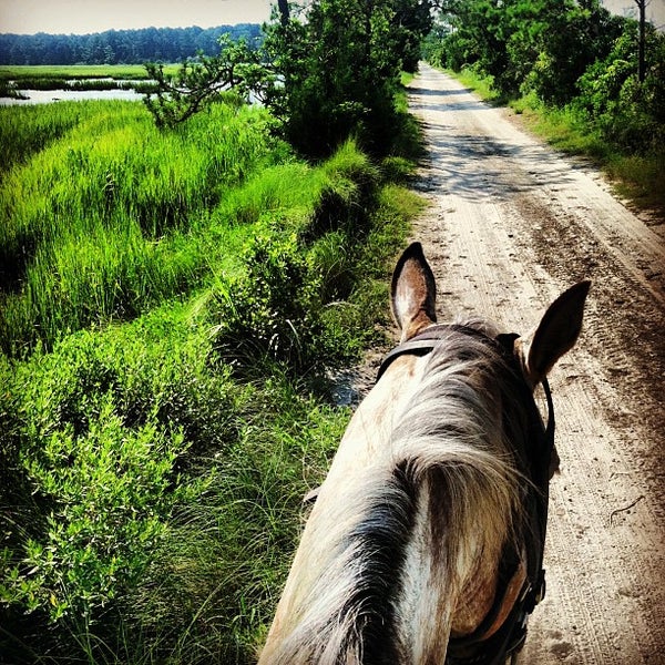
Currently the area of land known as, the Little River Neck area, is home to Inlet Point Plantation, a sprawling horse farm that offers rides on trails through the inland property as well as over the small causeway and onto Waties Island's beaches. If you aren't an environmental scientist or student with Coastal Carolina, or a Tilghman heir, the horse ride is your only option to access the untouched beach by land. Of course, there's always the water. That's how I arrived on Waties Island's beach.


Cherry Grove Public Boat Landing

 My Kayak Adventure

I googled kayak rentals in the area and the one that interested me offered several guided tours and even one called the Sunset and Lantern Tour. I quickly gave J and L Kayaking a call and made my reservation for that evening. It was winter but the weather was amazing. I drove over the bridge toward Cherry Grove Beach. Cherry Grove is a beach that was developed during the post WWII boom of the '50's and '60's and consists of beach front homes and rows and rows of homes on manmade channels. My mom vacationed there as a child. I drove towards the north west side of the island and met the guide and other kayakers around 3pm at the Cherry Grove Boat Landing.

Waties Island from the creek
We paddled slowly down House Creek towards Hog Inlet. It was perfect weather and the water was smooth. It was actually one of the most enjoyable kayak trips I've ever taken. A high pressure system had pushed away any clouds that morning and the bright sun was warm with a light breeze occasionally. As we passed through the homes of Cherry Grove we were greeted by a paddle boarder with a dog who was dancing and jamming out to music as he paddled downstream. Because there were two families with us and unexperienced kayakers, I was able to paddle around quite a bit by myself while they slowly made their way down the creek. It was immensely relaxing. The island has suffered erosion at both inlets due to dredging and the heirs even sued at one point for lose of property. The stand of tall trees you see in these pictures is slowly eroding into the water.

My Sand Dollar
We beached our kayaks just before the inlet at Hog Point. We had time to walk the beach before sunset and enjoy the solitude. I found a sand dollar almost immediately. The beach was huge, and serene. There were no footprints. No tracks from lifeguard vehicles or tourists dragging their stuff through the sand. I did see evidence that a couple had recently come through on horse back, at the low tide line was a pair of tracks disappearing and reappearing in the gentle waves.
Dusk on Waties Island
We enjoyed the beach until dusk when the guide called us back to the inlet. Sunset was coming. From Hog Point we would be able to see the sunset over Cherry Grove. A mist started to roll in off the ocean, it was beautiful. As the sun began to set a flock of birds flew across the inlet. The guide was handing out the lanterns, they're inflated waterproof glowing cylinders. As the sun dropped below the horizon we launched our kayaks back into the creek. 

Night Kayaking

Sunset, Hog's Inlet, & Cherry Grove
 I launched first and paddled out away from the families as they slowly got in their kayaks and were pushed out into the water by the guide. I absorbed the feeling of the air. The light moisture coming in off the Atlantic, the salt smell, the lapping of the water under me, the moments just after the sun has set when the sky is still full of a complex range of colors, I took deep breaths and soaked it all in. The lantern that J and L provided was the perfect amount of light for people to see the kayakers but still not obstruct night vision. I had never kayaked at night before. I had always wanted to and I had paddled out during sunset, but never far enough to be paddling home in the dark. It was so peaceful. 

There were bird sounds, and there were bug sounds, and there were frog sounds, and the sound of the paddles in the water, but there were no other sounds, until we were paddling through the large homes of Cherry Grove where there were sounds of laughter and music. It was obvious that it was the down season, as only a handful of homes looked occupied, most were dark, silently awaiting the return of warmer weather and weekly renters. 
I highly recommend the J and L Kayak experience, if you are in the area and want to get back in touch with nature, its a great escape. 
We are lucky that the families who inherited these properties believed in preservation. Driving away through the tightly packed homes of Cherry Grove I thought about the beautiful high marsh behind Waties and realized that is what this island looked like before it was cut up with channels and developed. Little River is a perfect place to take in nature or history and get away from the hustle and bustle. It is much more than a fireworks stand.


Oak Hollow Camp Ground

  I haven't blogged in a while, I went down the ancestry research rabbit hole for a while and also have been working on home projects, f...