At the age of 62 Robert Harrill hitchhiked his way to the end of the earth. If you start driving east in the foothills of North Carolina and don't stop till you run out of land you might end up there too. Fort Fisher is the tip of a peninsula called Federal Point, just before you get to the islands that make up the Cape Fear. Growing up on the coast, I heard stories about the Fort Fisher Hermit my entire life. I think the very earliest I remember learning the story was the early 1980's, I was four or five. My twin sister and I were sitting on a beach blanket in the back of our family's Carolina blue WWII Jeep.
We were holding on as we bounced along the east beach on Bald Head Island. We often went out to 'the point' where the east facing and south facing beaches come together and form the cape. This was the first trip I can recall when we headed north up the beach past Middle Island and into the 12,000 acre preserve. We went all the way to the New Inlet, which by then was not so much an inlet as a flat where the ocean reached across the sand at high tide and spilled into the marshy bay behind it. It was high tide by the time we had our picnic lunch and so going the rest of the way up the beach to Fort Fisher was not an option. Story telling was. Dad told the tale of an old hermit who had lived just up the beach from where we were. People from all over drove out on the beach from Fort Fisher to sit with him, hoping to gain wisdom from his lifestyle. The ride up the beach seemed endless and there was nothing out there but sand dunes, marsh, wind stunted junipers, and palm trees. I imagined the hermit, as a man on a deserted isle.
That is probably how popular culture has imagined him as well. The truth is, he was a troubled homeless man who opted out of the pressures of modern American society. Harrill was raised in an abusive home, they were poor, with no electricity or indoor plumbing. He spent a lot of his childhood playing in the woods to escape the traumatic home life. In 1913 he got married and the couple had five children. It wasn't a happy home. The eldest son tragically took his own life and Harrill's mental health deteriorated. He was unable to hold a job and support his family. His marriage was failing. His wife knew he would no longer be a caregiver for their family. During the Great Depression the marriage ended and Harrill was institutionalized. In 1955 he took his fateful hitchhike ride.
Life in and out of mental facilities, jail, and, halfway houses was terrible and Harrill decided it was only making his condition worse. Life would be better by the beach. Several hundred miles later he saw the ocean. He walked from Carolina Beach down to the Confederate Fort where he camped for a while in a tent. He was considered a community nuisance, as he was collecting things off the beach and living on land he did not own. He was charged with vagrancy and trespassing but upon release went right back to life by the beach. He met another hermit who lived in the area. Empie Hewett, had lived most of his life in the marshland around Fort Fisher and taught Harrill many necessary life skills. Harrill adapted to his life by the beach with much more success than he had life in the 'real world'. He moved into a concrete bunker that had been built during WWII. He furnished it with driftwood and seashells and anything else that washed up on the nearby beach. He didn't suffer from lack of food. He planted veggies and gathered berries and nuts. He ate an abundance of seafood, crabs, shellfish, flounder, and all sorts of surf fish. He made a hat from palm frons and wore nothing but it and a pair of shorts most of the year. Because Fort Fisher is home to a military recreational facility, people came from all over the country.
They spread the word of the philosophical beach bum far and wide. Eventually, Harrill became one of the most popular tourist destinations on the coast. Beatniks, hippies, and square but curious suburbanites made pilgrimage to his sandy home. Locals partied with him around the bon fire each night. He was rarely alone. People left money in an old cast iron pan outside his home. They also brought him supplies, warm clothes in winter, and booze. Stray dogs had a way of finding him and settling down. Life by the beach was better.
In 1972 a group of college age boys went down to visit the hermit and found his body. The crime scene photographs tell a different story than the police official report. Hindsight is 20/20, but there was an obvious cover up. His death was ruled natural and his family was notified that he died of a heart attack, only learning the truth sometime in the next decade. His body had been found battered and covered in marsh mud and sand, dragged from the marsh up into his bunker, tossed on a pile of trash and then closed in with some boards. The truth shocked the community. Demands for an investigation led to release of the crime scene images and public interest reignited. Books have been written, movies, documentaries, and plays have all been produced. Fort Fisher State park and recreational area has added a well maintained trail out to the bunker, which now has a plaque, commemorating the famous man that lived there for 17 years.
Tourists from all over can still visit his home and his gravesite, where people continue to leave coins in a cast iron pan. He is buried in the historic Federal Point Cemetery, in the Dow Road Woods, just north of Fort Fisher. (Click HERE to read about the cemetery and what's hiding in those woods.) Watch the movie below for a great look at the life and death of the Hermit of Fort Fisher. Warning: Movie contains crime scene photos, including his body.
The geographic origins of the Carolina Shag are obvious by it's name, but it's history is more of a mystery to most people.
You may not even know what the Carolina Shag is if you're not from the east coast. Perhaps you can think of pop culture references to the dance. In 1997 the country music band Alabama had a hit song called, "Dancin', Shaggin' on the Boulevard". The song, written by Randy Owen, Teddy Gentry and Greg Fowler, peaked at No. 3 on the Billboard magazine Hot Country Singles & Tracks chart. It was about the band's early days playing beach music in Myrtle Beach, SC at bars on Ocean Boulevard.
You might think of the dances in the musical "Hairspray". This campy musical is actually a good hint to the truthful history of the Shag. The musical is set in 1962, following a "pleasantly plump" teenage girl named Tracy Turnblad. She is pursuing stardom as a dancer on a local TV dance show. The tension in the plot is due to her anti segregation views. She danced at places that were for nonwhite people and rallied against racial segregation, because the dance moves that made her popular had come from people of color she'd been dancing with.
The Shag originates in the Jim Crow segregated south. Historians say the term shag was coined at Carolina Beach, NC. It wasn't always called that. The dance was popular from Wilmington, NC down to Georgetown, SC. White people doing swing dances like the jitterbug started calling a dance they were doing the Carolina Jitterbug. The name they had been using before that paid homage to its true origins; the Little Apple was the white version of a dance called the Big Apple. Called little because white dancers performed a less flamboyant version of the dance. The Big Apple got its name from a SC club for people of color in the 1930's where the dance originated. Fictional Tracy Turnblad wasn't the only white person "jumping the Jim Crow rope" and going to the segregated clubs.
Dancers on the coast popularized the Shag just as segregation was coming to an end. Beach music, which was heavily influenced by the blues, became popular on commercial radio as baby boomer teenagers wanted something they could swing dance to. Beach music bands of all races were played on the radio and allowed to perform for mixed audiences. The popularity of beach music was pivotal in a wider acceptance of music from musicians of color. The musicians who'd developed their beach music in the segregated clubs also played Rhythm and Blues. White musicians began covering the R&B songs from musicians of color. This, as we all know, led to the invention of Rock and Roll. Today 'cultural appropriation' is a hot button topic but it's nothing new. Eminem rapped about it in the 2002 song 'Without Me.'
"Though I'm not the first king of controversy, I am the worst thing since Elvis Presley, to do black music so selfishly, and use it to get myself wealthy."
If you listen to popular music today you can't escape the influence of the Carolina Shag. From hip hop to pop country, dance music still breaks down racial barriers. That next dance craze the kids are into might even spur a revolution, you never know.
The Journey Is The Destination I know my posts are very long. That is purposeful. I want you to spend time sitting with the history of these places. I want you to think about the ways humans have shaped these natural areas and how resilient nature can be when protected. I want each post to add to your understanding of the varied ecology and culture of the southeast. I want you to think about the civilization that existed here for thousands of years before the invasion from Europe. I can't tell these stories without mentioning the atrocities of slavery and its affects on our society. I want you to see what industry and commercial development can do when left unchecked, and enjoy the beauty of land reborn. In many places around the country we are in quarantine, bars are closed, there are no nightclubs, restaurants have limited seating or are take out only, people are working from home, kids are online learning, you have time to read a long blog and take your mind off all that. I have included links throughout my blogs so you can do your own research and learn more about all the people and places. If there is a term you don't know, likely it will have a link attached. If there is a historical person mentioned more than briefly the name will be linked. If I mention another of my blog posts, it will be linked. Feel free to use my blogs as your entrance to the rabbit hole of history.
So far we have traveled together three times. In South Carolina, we visited a castle built by trust fund philanthropists, learned about antebellum rice plantations with their overstuffed owners, and met the woman who made indigo a Carolina cash crop.
In the mountains of North Carolina we traveled through time and up into the hills of Cherokee territory, witnessed the disneyfication of a culture, got a picture with Chief Henry, peered down at the poor neglected bears, put quarters into Skinner box style ‘animal arcades’ and spent the night in the Pink Motel.
And most recently we traveled from the Piedmont to the Cape Fear Coast, busted a gasket in the swamp, met the native people, pirates, lord proprietors, and briefly pondered such mysteries as the swamp Beast of Bladenboro, secret stashes of Nuclear weapons, Nazi submarine attacks, and a near death experience that inspired a name for an entire region and its people.
What next? Where would y’all like to go? Or where have you been that I should learn about?
My love of nature began at a very young age. My twin sister and I were born on North Carolina’s Cape Fear Coast, a region with a ton of ecological diversity. I'll certainly be writing more posts along the way about some of the places I'll mention in this post. Stay tuned. But for now settle in and travel with me to a place of pirates, plantations, and plants that eat bugs! Cape Fear is a prominent feature on the east coast of North America. It is a headland that sticks out into the Atlantic Ocean. The Smith Island Complex of Bald Head Island (BHI), Middle Island, and Zeke's Island with their connective barrier beach and marshy back bay forms the cape at the mouth of a large river. Cape Fear is further shaped by the coming together of long shore currents creating 30 miles of Frying Pan Shoals. I could tell you a thousand stories about the natural beauty I saw growing up on the Cape Fear, but this time I’ll start with a story about a swamp. (Sorry, no camping in this post, I promise plenty of future posts about camping on the coast!) This post has tons of history and beautiful photos. (Most of which I do not own, but I tried to link to the source in the captions,) Road Trip! Let's take a drive to the Cape Fear Coast. It's a trip I've taken a million times and traveled a thousand different ways. Our mom was originally from the Piedmont and our family moved from Southport to High Point in the mid 1980’s. We went back to the coast every summer. In those days the route was 220 to 211. It was two lanes, 55 miles per hour speed limit past the Uharrie’s and farmland of Randolph and Montgomery Counties.
We would slow to 35 through the small towns in the shade of the long-leaf pine forests and white sandy plains of Hoke and Robeson, and finally we’d reach the swamps of Bladen and Brunswick, mom would drive fast the whole last stretch.
I loved the swamp!
I remember pressing my face to the window to look deep into the swamp searching for the glint of eyes looking out at us. There were stories of a swamp beast, and I wanted to believe. (Click HERE for a post about the Beast of Bladenboro.)
Even if there was no swamp thing, there were definitely alligators and giant bull frogs and snakes and who knew what other creatures. The swamp looked impenetrable, dark, and cool even on the brightest and hottest summer days.
Cabin near Supply. Photo: David Cecelski
I remember there were old mobile homes and little shacks every now and then on spots where the ground was a bit higher. No power lines or phone lines went to these places. I didn't even realize people lived in them till I was a little older and noticed clothes drying out on clothes lines, and fishing nets hung up on porches. I remember asking mama who lived there and she just said, “Indians.” “Like daddy?” I asked. My mom didn't answer..
On one particularly hot sticky trip through the swamp in our old Chevrolet station wagon with broken ac, the inevitable happened. About 40 miles from the coast, the car started overheating. Buzzers were going off, steam or smoke was coming out from under the hood, it smelled like burnt offerings and we were deep in the Green Swamp. This was a time before ubiquitous cell phones but even if we'd had them I doubt there's service to this day in the spot where our car decided to die. Mom started to pray out loud as she looked for a safe place to pull over.
It was wilderness, wet, dark, wilderness. The edge of the road dropped off into black water and weeds. Beyond that the woods were so thick no light was reaching the floor. It was no place to pull off the road so we kept going, buzzers buzzing, smoke billowing, Sugarbabe, our white German Shepherd whining, and mom praying. Then we saw a sign. In the distance on the side of the road we could see a sign with a white cross on it. “A church!” we all said in unison. In the middle of the swamp there was a church. The sign said, “do unto others.” It was a Baptist Church with a funny name. We pulled into the empty parking lot. There were power lines and a phone line going into the church. I tried the doors. All locked. No one was there. The sun was setting. I sat on the curb with Sugarbabe and started to cry, I was sure we’d be spending a sweaty night in the car there in that swamp church parking lot. Mosquitoes bit my skinny legs.
Somewhere close by bullfrogs croaked loudly back and forth at each other. I looked out into the dark of the wilderness. Something caught my eye. I held my breath, squinting into the dark. It was just lightning bugs. The shine of headlights and the sound of an old truck startled me back to the reality of the parking lot. Two men jumped out with flashlights, one had a tool bag. “We saw ya with yore hood up and went home to get light. What seems to be the problem?” He was already looking under the hood. “Oh dear.” he said, “Looks bad, did you overheat? Yore head gasket looks busted.” The other man said, “I radioed preacher, he's comin to let ya in, the church is the only phone round here for a ways.” About then a Cadillac pulled in and an older man and woman got out. He unlocked the church and she led us inside, even let us bring in the dog and got her a bowl of water. The church was small and had green indoor outdoor carpet from the wheelchair ramp outside all the way through the sanctuary straight up to the altar. That’s when I noticed it. A giant dream catcher hanging on the cross, Indians. Like daddy. The preacher’s wife gave us lemonade and church cookies, while the grown ups discussed things and looked under the hood. The car was officially dead, for the night at least. The preacher called his brother, a mechanic, and he agreed to come get it with the tow truck and fix it up first thing in the morning. The preacher's wife called her sister who managed a hotel in the closest town. They got us a room, we could even take Sugarbabe. In the air conditioned back of the caddie, crammed in with my sister, mom, and giant dog I was cooler than I'd been all summer.
Stock image
The next morning I walked outside and was blinded by the sun reflecting off the bright green of a field of tobacco. I could smell it, strong on the warm breeze. Our car was already fixed and sitting in a parking spot right in front of our room. There was a note that said we owed them nothing for the repair or the room, that the Creator had provided for our safe travel. The swamp never smelled as sweet as that morning, looking out the car window I could see steam rising at the base of the ancient trees.
Photo from Nature Conservancy
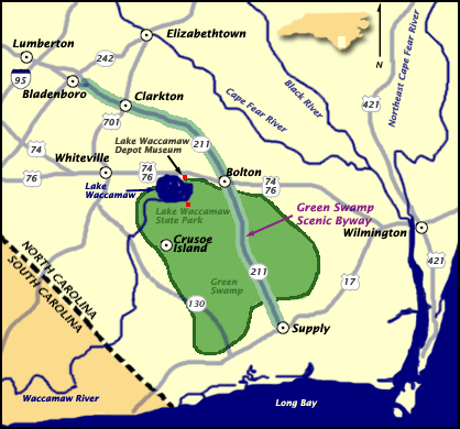
I always wished to stop and spend time in that swamp, but in the hurried going here and there I've never taken the opportunity, and now there’s several highway options that get me from Piedmont to coast in an hour less time. During my recent quarantine quest to virtual vacation I looked up the Green Swamp. It is actually a nature preserve.
The Nature Conservancy’s website is a great source for up to date information on trail conditions, they maintain 17,424 acres of long-leaf pine savannas and bogs in the Green Swamp. The trail head is off of 211. Southeast of 74, northwest of 17, in Brunswick county.
“The Green Swamp contains at least 14 different species of insectivorous plants, including extensive populations of Venus flytrap, sundew, butterworts and bladderworts, and four species of pitcher plant. The preserve is also home to many rare animals, including the American alligator, Henslow's sparrow, Bachman's sparrow, and Hessel's hairstreak butterfly.”
Today the Waccamaw Siouan tribal homeland is officially located on the edge of the Green swamp, 37 miles west of Wilmington, NC, but native people have lived in the land between the rivers of the coastal Carolinas for thousands of years. The Waccamaw, the Peedee, and the Cape Fear Indians all had settlements in the area at the time of the European invasion.
An Italian explorer hired by the French looking for trade routes to China was believed to be the first European to visit the area when he landed at Cape Fear in 1524. He wrote that the area had white sandy beaches with high dunes and a plain to the west that contained forests with trees that he said defied description. He continued up the coast wrongly believing he’d discovered the route to China when he saw the vast sounds to the west of the Outer Banks.
Just two years later the Spanish, who had established colonies to the south, landed at Cape Fear and attempted a short lived settlement. The Spanish continued to attempt northern expansion of their interests and failed repeatedly as they encountered struggles navigating the dangerous capes, faced resistance from the native people, and found traversing the swamps impossible.
The area got its scary name in 1585 when Sir Richard Grenville’s expedition stranded on the cape’s shoals at low tide. As the crew watched the waves crashing from two directions they saw sharks frenzied over stranded schools. They were terrified their ship would break apart and they would have the same fate as the fish. After the high tide released them they decided the cape would be named Cape of Fear, in honor of their worst fears.
The English had successfully established a colony in Virginia in 1606. They established a strong hold on the northeast, with the colonies of Maine, Plymouth, New Hampshire, Salem, Massachusetts Bay, New Scotland, Connecticut, New Haven, Maryland, and Rhode Island and Providence.
The English Civil Wars from 1642 to 1646, again in 1668, total turmoil, and a temporary dictator, Oliver Cromwell, led to an influx of immigrants to the new colonies from Scotland, Ireland, and Wales. Though often debated as to how severe, there is no debate that Cromwell focused his attention on committing atrocities in Ireland in the name of English colonization. There were murders, forced evictions, and the deportation of over 50,000 people officially labeled prisoners of war or indentured servants. After Cromwell’s awful reign, King Charles II created the Carolina colony in 1663 and gave ownership to Lord Proprietors, who then divided it to be sold to English merchants interested in settling the new world. Many of the poor Scotch-Irish who had immigrated to the colonies to the north moved south into the mountain and Piedmont regions of Carolina.
The southern part of the Carolina Colony was already thriving, as planters with connections to established colonies in the West Indies created a robust economy centered around the port of Charleston. North of Cape Fear coastal settlement had proved to be more difficult. The many shipwrecks along the capes led to the nickname of the Graveyard of the Atlantic.The regions began their development in separate ways. Recognizing the geography was making trade difficult, the Lords created separate plans for further development and split the colony into north and south in 1710, with the Cape of Fear being the divider.
Coastal plantations were benefiting from trade with England, as small subsistence farms dotted the land to the west. Acquiring slaves and participating in trade was difficult for inland farmers because of the vast swampy wilderness between them and the coast. There were political and social tensions between farmers and planters. The Lord Proprietors encouraged participation in the English mercantile system and slave trade. Plantations eventually spread out across the area, growing sweet potatoes, peanuts, indigo, rice, and tobacco.
Thomas Smith was granted the land around the cape in 1713, which included soon to be Smith Island (Bald Head Island) and Smithville (Southport). The following year, Thomas James was granted 1000 acres west of the Cape Fear River.
Stede Bonnet
This was the Golden Age of Piracy and the British were battling pirates along the trade routes in the Caribbean and Atlantic. The Battle of the Cape Fear River between infamous pirate Stede Bonnet and British Naval Officer William Rhett bloodied the waters in September of 1718. Bonnet was captured and was subsequently hung in Charleston.
In 1725, more land in the area was granted to Maurice Moore, Samuel Swann, Charles Harrison, and Eleazar Allen. Moore, a second generation planter who had defeated the Cape Fear Indians in battle, founded Brunswick Town in 1726 on the river just inland. (Just have to add that obviously the 'Cape Fear Indians' had a tribal identity not shaped by a white mans fear of dying shipwrecked on the coast he was 'conquering'.) In 1732 the town that would become Wilmington was founded further inland on the river. Near Brunswick Town in 1735 Moore built Orton plantation and began growing rice there.
As global trade increased, the need for lumber and tar for boats increased, and interest in the vast Carolina wilderness increased. In 1735 the swamps were explored by popular naturalist William Bartram who published a book about his travels through the south. Soon the area began attracting development. The rivers became routes for the export of trees to the naval yards.
In 1745 Spanish privateers were increasing attacks on English interests and a fort was built at the mouth of the Cape Fear River, Fort Johnston. Revolution against the British, technically began in 1776, but the war raged on for seven years. One of the last Revolutionary War campaigns in North Carolina was the Wilmington Campaign of 1781. Brunswick Town did not survive the revolution, though Orton plantation did and its owners eventually bought the land that had been Brunswick Town for pocket change. In 1792 the town of Smithville grew at the mouth of the Cape Fear River around Fort Johnston. The town was named after revolutionary war colonel, area planter, and eventual governor, Benjamin Smith. In 1795 Benjamin Rowell sold 25,000 acres of swampland west of Smithville to Smith for '2,000 pounds'. In 1797, the state sold close to two hundred thousand acres of the Green Swamp to planters Stephen Williams, Benjamin Rowell and William Collins for around $7,000. Some of the land was ditched and drained for farming.
In 1802 the senate first made a proposal for an Intercoastal Waterway (ICW) on the east coast from the Gulf of Mexico to Boston. The Great Dismal Swamp Canal on the VA/NC border opened in 1805, while the Army Corp of Engineers (ACOE) began work on other sections in 1824 with a goal of making the coastline more navigable.
A lighthouse was built on Smith Island in 1817 to mark the mouth of the Cape Fear river. (For certain, I will write a future post about Old Baldy.) During the Civil War blockade runners defended the people and supported the struggling economies of the port and river towns. Many inland towns were battlefields. The thick swamps protected others from the wrath of Union soldiers. The tribes in the swamps and along the rivers welcomed runaway or freed slaves into their communities. A fort was built north of Cape Fear at the New Inlet. Fort Fisher, Fort Johnston, and Fort Caswell defended the area from the Union Army. Wilmington was one of a very few southern cities to escape destruction. During reconstruction, carpetbagging northern industrialists treated the south as the spoils of war. Owners of paper mills recognized the potential of the quick growing pines in the savannas and began buying acreage in the late 1800's. The Jim Crow era brought tense race relations. The white supremacy movement was angered by the success of freed slaves and other free people of color and began promoting discord between native populations and free slave populations. They also moved within political circles to create laws hindering non whites. People of color and poor whites in the coastal area were violently forcibly removed from the centers of commerce and positions of power. Under Jim Crow a separate second class developed in the south and created an economy of fishing and subsistence farming.
As the industrial revolution continued the poor people in the area began taking work in mills. Work conditions were not safe. Industrialists were unconcerned with the welfare of their employees or the impact they were having on the valuable natural resources they were utilizing.
After the first world war, amid the environmental destruction of the industrial revolution, a nostalgia for agrarian life led wealthy families back to the rural south. This southern renaissance led to renewed development on the coast. In the 1920’s the proposed development of “Palmetto Island” on Smith Island (BHI) resulted in clearing land to make way for roads, the building of a pier, a pavilion, and a hotel that was never completed.
From 1929 to 1932 the ACOE completed a channel that cut across the Cape connecting the river and the Myrtle Grove Sound which has an inlet to the Atlantic. Snows Cut was named after the ACOE Major in charge of the project. The channel was span with a wooden drawbridge until 1931, then a steel swing bridge, which was replaced with the current high rise concrete structure in 1962.
The Ethyl-Dow plant was built in 1934 on the river banks between Snows Cut and Fort Fisher. The plant extracted bromine from seawater. During WWII it became an important military installation, one of many important area defense industry locations. The legend anyone from around the area will tell you is that the Nazis bombed the Dow plant. It was decommissioned and demolished but the brick and concrete ruins can still be found in the woods off of Dow Road between the towns of Carolina Beach and Kure Beach. (Future post on that place for certain!) In 1951, Sunny Point Military terminal became official as the largest east coast location for the transport and storage of munitions just across the river from the Dow site.
Another wave of people moved to the coast as the spread of air conditioning made life in the humid swampland more hospitable. The post war era in American was marked with massive economic growth and a pop culture boom. 1960's Hollywood helped spur a global fascination with surfer beach culture, sending families and teenage boomers to the coast in droves. Real estate development of coastal areas became extremely lucrative.
Ocean Isle
Some marshland on the west sides of the sandy barrier islands was canaled to create rows of vacation homes with dock access. Frank Sherrill had a development plan in place to fill and dredge thousands of acres of wetland and marsh on Smith island for development of a modern resort. There was to be high rise hotels, shopping, amusement rides, and a replica pirate ship in Buzzard Bay.
Environmentalists discovered what the first explorers noted: that the cape fear area of NC was home to a complex range of flora and fauna. It was the boundary line between the temperate zone and the subtropical zone. There is some biology there that doesn’t exist anywhere else in the world, like the Venus flytrap. Fights between developers and environmentalists made the papers.
Preservation of the area began in 1969 when 761 acres of cypress swamp, old growth live oak and long leaf pines stands, and bogs full of carnivorous plants, along the Cape Fear River was preserved as Carolina Beach State Park. (Future post about camping there.) The area around the Green Swamp which was owned by paper producers was designated a national natural treasure. Smith Island was bought by Carolina Cape Fear Corporation, a group of outdoors-men from the Piedmont who planned responsible development and immediately gave 12,000 acres to the state for preservation, managed today by the Bald Head Island Conservancy and the North Carolina Nature Conservancy. (I could write a book about BHI, but I'll save the stories of that amazing island for future blog posts.)
In 1970 construction began on the Brunswick Nuclear Generating Station along the river just south of Orton Plantation beside Sunny Point, just north of Southport. This further fueled local speculation that Sunny Point had nuclear weapons. The power plant uses water intake from the river to cool it's reactors, and a drainage canal leads the hot water away through the area's wetlands and out into the ICW just south of Southport. There has always been some controversy as well as a great deal of urban legend surrounding the power plant.
By the late 1970's environmentalists had created global awareness about the dangers of deforestation, promoting recycling, and painting the paper industry as wasteful tree killers. The companies rushed to save face. The Federal Paper Board donated their swampland to the state, creating theGreen Swamp Preserve.
Today, 14,000 acres of land is protected, maintained by the Nature Conservancy, and they maintain trails where visitors can walk through the bogs and the savannas and observe the rare bug eating plants and if lucky the even scarier snapping jaws of the American alligator.
The trails are currently open, and social distancing is required.
During my rebellious youth I turned my nose up at campgrounds like KOA. I thought I was too cool to camp with bathrooms and electricity, and because I had camped there as a child, I thought it was for families and old people. Haha, now I am the old person with a family. I still like to rough it occasionally, but now I realize there is something to be said about a campground with amenities. Especially when it's in a location with loads of interesting things to do and beautiful sites to see.
Cherokee, NC certainly has lots to do and see. The story of this land and its people has literally become the stuff of legends. Everyone you meet in the southeast has a story about a ‘Cherokee princess’ that was their great great auntie. People scoff at this, and brush it off as southern mythology, but it is a common occurrence in places that have experienced genocide. To escape death, people assimilate and after a few generations they lose their cultural and racial identities.
Cherokee people or their ancestors have lived there for thousands of years, once controlling 40,000 square miles. The dense woodland and steep terrain in the mountains helped protect some of them from the initial invasions of Europeans.
According to legend first contact occurred when an ancestral town was visited by Spanish Conquistador Hernando de Soto in 1540, it wasn’t a pleasant experience.
The Cherokee were the largest tribe in the southeast at the time of English colonization. The coastal elites had no interest in pioneering the rugged mountain terrain and it wasn’t until the 1750's that poor second or third generation German and Scotch-Irish immigrants began moving to the mountains from Virginia and Pennsylvania colonies. A group of working class Scotch-Irish immigrated directly from Europe just before the Revolution. All of these pioneers were brought to the area by the cheap land as the new colonial upper class had driven up real estate prices.
The Cherokee were experienced traders and had already created a thriving economy shared between the eastern tribes. They led these tribes into trade, military alliances, and real estate negotiations with the Europeans, leading to the nickname of the civilized tribes. (Clearly, it should go without saying, how terrible it is that people had to change their way of life to fit the western idea of what was considered 'civilized' when it was their civilization that had existed on the land for thousands of years prior.)
The English, who were developing the Carolina colonies, notoriously cheated the tribes. Then the Cherokee lost another large portion of their land holdings after choosing the losing side in the Revolutionary War. The Cherokee adapted to their new economic reality and began to further assimilate, they created an American style government structure and colonial style homesteading.
Despite their efforts, in the 1830's increased desire for land resulted in the Indian Removal Act which led to the atrocity known as the Trail of Tears. 16,000 Cherokee were evicted from their homes by the United States military and forced to travel a grueling 116 day journey to Indian Territory in Oklahoma. 4,000 died.
A small number of the tribe secreted themselves in the mountains and were able to avoid removal.
During the Civil War the Cherokee who managed to stay on ancestral land in the Great Smokies joined with Scott-Irish highlanders in an attempt to impede the Union’s progression southward. After the war large scale timber operations owned by wealthy outsiders milled wood for the state’s budding furniture industry.
In the 1870's, The Eastern Band of Cherokee were able to purchase (yes, buy back a tiny percentage of their own land from the people who stole it.) about 50,000 acres of the land in the river valley, which the federal government eventually recognized as the Qualla Boundary.
At the end of the rapid industrialization of the 1800's, that led to the wealth of the Gilded Age, the laissez faire attitude of the government when it came to regulations began to show its consequences, mining and lumber industries stripped much of America of its beautiful natural resources. Early environmentalists and outdoors enthusiasts took notice, and finally so did congress, who passed several acts to insure the continuous availability of natural resources.
In 1911 the Weeks Act allowed the federal government to buy land for preservation of watersheds and timber lands in the national interest. The goal still wasn’t preservation in the modern environmentalist definition but preservation for responsible use, government maintenance, or control, of natural resources and transportation corridors. Under The Weeks Act, the government began purchasing land in the mountains of NC and Tenn. Land that had once belonged to the Cherokee.
Some of the Gilded Age wealth began to trickle down as the philanthropist children of industrialists became interested in nature, or at least, their purified version of it; carefully planned, developed and preserved as parks, with public restrooms, and a modern road system complete with scenic overlooks.
Edith Vanderbilt, sold 86,700 acres of their Biltmore Estate in 1914 to the government for the Pisgah National Forest, which was officially established two years later as one of the first created under the Weeks Act. Click HERE for more about the Vanderbilt's.
Cherokee National Forest in east Tenn, and Nantahala National Forest in southwestern NC were established in 1920. Nantahala means land of the noonday sun in Cherokee because the forest is so dense that the sun only reaches the woodland floor at high noon. The National Park Service, created in 1916, made it publicly known that they were interested in creating a park somewhere in the eastern United States. Congress authorized the creation of the park in 1926, but there wasn’t any money allocated to the project.
Philanthropist heir to the Standard Oil fortune, John D. Rockefeller, Jr. gave $5 million. The government was convinced to put up $2 million. Investors from NC and TN began purchasing land and evicting the remaining timber and mining operations. This displaced families who were living in the small communities run by these companies. Many of the native families moved to Cherokee land.
During the Great Depression, the CCC, the WPA and other New Deal organizations built the park's infrastructure and gave jobs to those left behind by the removal of industry. Some Cherokee opened boarding houses for the workers. In 1940 it was finally officially chartered as a National Park.
This began a new chapter for the Eastern Band Cherokee; the creation of an economy totally reliant on tourism. Not just ecotourism, Americans were traveling to the park for the beauty of the mountains, but they were also drawn by their curiosity and romanticism of Native culture. Families displaced or jobless from the creation of the park began to cater to the tourists. Those who had run boarding houses opened inns, or rented small cabins along the river.
The post WWII era in America gave way to a pop culture explosion. Hollywood loved the story of the ‘cowboys and indians’.
Cherokee became a mecca for kitschy roadside stops, drawing in crowds of tourists with flashy neon signs, giant sculptures, and tee-pees, (the Cherokee built log homes, not tee-pees). There is a 25 foot tall shirtless Indian (Currently in storage pending relocation, stay tuned for an update on him.)
The old inns were advertised with rustic frontier style signage, or cartoon symbols associated with Native American people. The new motels had modern neon signs and swimming pools. Gift shops and animal attractions had billboards and totem poles, (the Cherokee did not historically have totem poles).
That’s the Cherokee that I vividly remember from my childhood. A place with a surreal quality to it that at the time I didn't understand. Philosopher Jean Baudrillard would have said it was an example of the hyper real, the real was replaced by reproductions that were disconnected from the reality of the original thing. The age of industrial expansion in America created a commercialized version of reality where everything became like Disneyland. (Click HERE for my post explaining Disneyfication.)
“Chief Henry”, ‘the most photographed Indian in the world’ greeted tourists at the strip of souvenir shops for 60 years. He sold his image, families would line up to pay to have their pictures taken with him bare chested wearing a headdress. He died of lung cancer in his 70's.
I remember the street corner chiefs. For a dollar they'd pose for a picture with you. I also remember squealing with delight as I put quarters into the animal arcades to watch chickens, ducks, and rabbits perform tricks like dancing or playing tiny instruments.
I got in trouble once when I was very young because I got away from my parents inside the souvenir shop and ended up walking out to the bear attraction. They found me there, staring down at a sad skinny bear in a concrete pit resembling a small swimming pool. Cherokee had three bear attractions back then, all of which have come under scrutiny from animal activists and pressure from tribal leaders.
Although the animal attractions may no longer be a tourist draw, some of the original roadside sites are still around. It is truly an Instaworthy town. There are still countless atomic era motel signs.
One of my strangest memories of Cherokee in the 1980's was lit by the neon of one of these signs. We were camping in a tent by a river in the KOA campground with mom, her best friend and her son. The first night it was very cold, throughout the next day it got even colder. As the sun began to set beyond the mountains it started snowing. The moms broke down the tent while the kids sat in the running car. We drove to the nearest motel. It was pink. Heck it was literally called the Pink Motel.
It was not in the best shape, everything was from the sixties. But the sign had Tinker Bell on it and it had heat. There was a color tv. An earthquake had hit California and Johnny Carson wasn’t on. Instead it was terrifying images kids our age probably shouldn’t have been watching. The moms turned it off. Pink neon from the sign lit the room all night and I couldn't sleep. I stared at the popcorn ceiling, the shag carpet, and the pink door with all it’s locks. It was scarred, like someone had repeatedly thrown their knife into it.
The Pink Motel is still there and has been updated. The sign is a popular stop for photography.
Everyone jokes about the myths of Indian Princesses, but The Pink Motel was built by an Indian Queen. Lois Queen Farthing was born to an English father and a Cherokee mother who had cabin rentals for tourists after being displaced by the park. Her Cherokee grandparents had run a boarding house for the CCC. They raised her to be a strong independent business woman who first opened a hotel with a restaurant and gift shop at the age of 23. When she opened the Pink Motel her daughter wanted Tinker Bell on the sign, and it became a landmark. She was very civic minded and became integral in bringing the Unto These Hills performance to the area, the outdoor drama about Cherokee history which has now been seen by over six million people.
There are plenty of camping options and loads of motels in the Cherokee area, but I definitely want to plan another trip to the KOA. They have river side sites with electricity and water hookups. Tent campers and all sizes of RVs welcome. Next time I'm going when there is no chance of snow!
 At the age of 62 Robert Harrill hitchhiked his way to the end of the earth. If you start driving east in the foothills of North Carolina and don't stop till you run out of land you might end up there too. Fort Fisher is the tip of a peninsula called Federal Point, just before you get to the islands that make up the Cape Fear. Growing up on the coast, I heard stories about the Fort Fisher Hermit my entire life. I think the very earliest I remember learning the story was the early 1980's, I was four or five. My twin sister and I were sitting on a beach blanket in the back of our family's Carolina blue WWII Jeep.